
SBAS Transmission Service
This service transmits the SBAS (Satellite-Based Augmentation System) signal which used with GEO satellites to provide augmentation information about range error corrections and navigation satellite anomaly to aircrafts, etc. It can be used on SBAS (L1Sb) receivers.
SBAS signals are also transmitted in North America, Europe, and other regions as well as Japan, and are operated with authorization by the aviation safety authorities of each country as a system for aircrafts. It is possible to set safety and efficient air routes in order to be able to navigate accurate aircraft positions by the SBAS.
In Japan, the SBAS signal used to be transmitted from MTSAT (Multi-functional Transport Satellites) operated by the Ministry of Land, Infrastructure, Transport and Tourism (MLIT). The SBAS signal that is made by MLIT is now transmitted from QZS on a GEO using the QZSS SBAS transmission service from April 2020.
-

Overview of the Quasi-Zenith Satellite System (QZSS)
-

What is the Quasi-Zenith Satellite System (QZSS)?
-
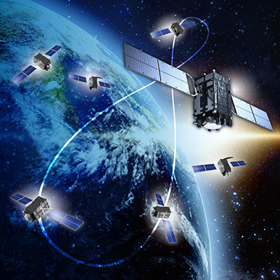
QZSS is Becoming a Seven-satellite Constellation
-

Advantages of QZSS
-

Service Comparison
-

Transmission Signals
-

Satellite Positioning, Navigation and Timing Service (PNT)
-

Sub-meter Level Augmentation Service (SLAS)
-

Centimeter Level Augmentation Service (CLAS)
-

Multi-GNSS Advanced Orbit and Clock Augmentation - Precise Point Positioning (MADOCA-PPP)
-

Satellite Report for Disaster and Crisis Management (DC Report)
-

QZSS Safety Confirmation Service (Q-ANPI)
-

Positioning Technology Verification Service
-

Signal Authentication Service
-

Public Regulated Service