User Guide (Personal Use)
Improved positioning accuracy makes travel and leisure simpler
Assisting in the creation of position information records
Satellite positioning consumes a lot of batteries, so mobile phone batteries are consumed rapidly if positioning is carried out consistently. For that reason, when recording positions and times consistently—such as while jogging or cycling—people normally use special receivers for GPS positioning.
Mobile phones can obtain highly precise position information by receiving augmentation information—such as ionospheric information—from base stations. On the other hand, GPS receivers can be used for high-precision positioning via the augmentation service of QZSS.
The satellite positioning service of QZSS (Michibiki) makes stable, highly precise positioning possible, allowing the usage of various position information services. For example, after returning to your home you can see a three-dimensional depiction of your route and distance traveled atop a map. In this way, QZSS is useful for your future activities.
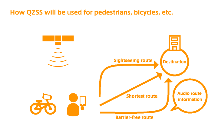
Reliable pedestrian navigation services
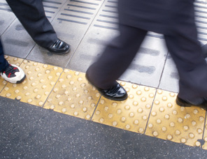
When providing navigation services to pedestrians, it is necessary to convey detailed information about roads, including which side they should walk on and which pedestrian crossings to use.
Because stable, highly precise positioning can be accomplished with the satellite positioning service of QZSS (Michibiki), detailed information introducing specific stores and facilities can be provided, allowing users to select the route that best matches their goals. This includes routes that help them to reach their destination fastest, routes with many pedestrian arcades, routes with few stairs, and scenic routes.
Pedestrian smartphone navigation apps with audio guidance make it easier for visually impaired people to find their destinations and travel more safely. Detailed information can be provided, such as where the user should go after exiting a train station, and the position of the entrance to the building they want to find. In this way, more safe and reliable travel becomes possible.
Equipped with safe, reliable features
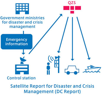
QZSS (Michibiki) will send reports for disasters and crisis management (DC Reports) in the event of an earthquake, tsunami, or other disaster. DC Reports require continuous reception, so they must be received on devices equipped with batteries. For that reason, these reports will be sent to public buildings (such as schools and hospitals) and road facilities (such as street lights, traffic lights, and vending machines). Afterwards, reports will be transmitted by broadcasting alarms from speakers.
Batteries are an issue for the usage of devices such as mobile phones, so reports will also be transmitted via regular online services such as social media at the same time as satellites.
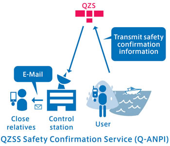
In addition, Q-ANPI (the QZSS safety confirmation service) can send e-mails via satellite to close relatives and other persons if means of communication are cut off during times of disaster. If you get into an accident on the ocean or in the mountains during normal circumstances, you can send a rescue request including position information, and close relatives, on receiving such rescue request could notify the authorities concerned. In this way, it will be easier for rescue teams to find you. Besides accidents, you can also send position information to your close relatives to bring them peace of mind.